Thursday, February 24, 2011 - Bosque Birdwatchers RV Park, San Antonio NM
< previous day | archives | next day >

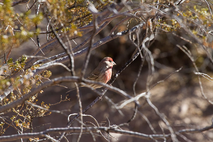
House Finch, Bosque Birdwatchers RV Park, San Antonio NM, February 21, 2011
How did you do that?
I've been asked how I made the House Finch portrait I posted Tuesday. Here's what you do.
First, like me, go take a bunch of bad pictures.
Before throwing the whole bunch in the digital dust bin, try to salvage something.
Pick out the pictures where the camera was at least clever enough to focus on the Finch rather than the creosote bush he was hiding in.
Select the one picture with a decent expressive pose and some light in the eye.
In my case, shooting at the 8 frames per second the Canon EOS 7D is capable of gives me lots of pictures to choose from and aside from the huge disadvantage of having a lot of junk to wade through, the high frame rate does increase my chance of coming away with at least one picture sharp enough and composed well enough to do something with.
Cropping to a composition that works with the out of focus creosote branches.
When that doesn't work try reducing the exposure enough to leave just the over-exposed Finch lit.
Bingo!... add little sharpening, some noise reduction and a bit more cropping and call it good.
Night camp
Site 10 - Bosque Bird Watcher's RV Park, San Antonio NM
- This is a basic, small Mom & Pop RV Park with full hookups.
- Verizon cell phone and Broadband service are available here with a strong signal.
- Locate Bosque Bird Watcher's RV Park on my Night Camps map
- Click for Google street view
- Check the weather in San Antonio NM
Passing Time in Byzantium
..Byzantium has begun to look suspiciously like my hometown. It has the same people, the same houses, the same goings and comings. But I am a very wise child seeing things very differently. The activities and interests of adults mystify me. They appear senseless. It is like watching the TV with the sound off--and suddenly realizing how ridiculous people actually are.
I expect adults will in turn regard me as ridiculous. Actions people might accept in a child may not seem appropriate in a grandfather. I won't be distressed. I am looking forward to new heroes and new adventures. And if you ask me where I've been I'll say "out"; and if you ask me what I've been doing I'll say "nothing."