Saturday, March 21, 2009 - City of Rocks State Park, Faywood NM
< previous day | archives | next day >

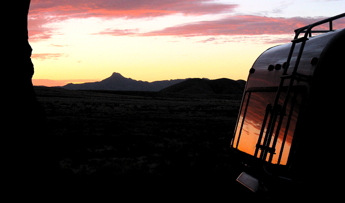
Taylor Mountain Dawn, Site 12, City of Rocks State Park, Faywood NM, March 21, 2009
Mystery circles at Finger-Ring Draw

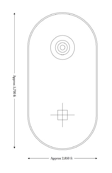
Finger Ring scale drawing
Poking around the City of Rocks neighborhood in Google Earth I came across an array of what appear to be stone circles in Finger-Ring Draw, over the other side of Cook's Peak. What are they? At least I think they are made of stones. It's hard to tell in the image. Check them out on this Google Map.
http://maps.google.com/?ie=UTF8&ll=32.469038,-107.602587&spn=0.023534,0.038195&t=h&z=15
Googling Finger-Ring Draw or the nearby Cooks Spring Historic Site turns up nothing about them. Huh?
Scaling off the Google maps image I came up with this drawing. This thing is HUGE, over half a mile wide and over a mile long! The outer oval is about 2-3/4 miles around. The whole thing is surprisingly geometrically precise on uneven terrain. Even with surveying equipment it would take a fair bit of effort to lay out those circles and oval. Who built it? When? Why? Where can it be seen from? By whom? What does it mean?
Ah! A thought. The axis of the oval is aligned north/south - but is not quite perfectly aligned with the Google Maps north/south axis. Knowing the precession rate of the earth's magnetic pole and the alignment of Google Earth's map, could one estimate the date this thing was built? A closer look with Google Maps seems to show the axis aligning with Florida Peak to the south. And the circles built on fairly flat terrain where it probably isn't visible in alignment, except maybe from Florida Peak, 20 miles to the south.
Update
I'vre started gathering my research on these circles at What are those Circular Symbols drawn in the desert at Finger Ring Draw?.
Night camp
Site 12 - City of Rocks State Park, Faywood NM
- Verizon cell phone service - fairly good signal - best on west side of the park
- Verizon EVDO service - faster than many places I've camped
- Go to City of Rocks State Park website
- Locate City of Rocks State Park on my Night Camps map
- Check the weather here
From Knowledge to Wisdom
Wisdom is a product of a process. This process begins with information, proceeds through knowledge, and through what a less gifted poet, Edgar Guest, called "a heap of living," ends in wisdom.
... Wisdom, when it comes, usually arrives late in life. I've known some people who were wise in their early thirties and others who died old without a clue. Most philosophers were of the mind that a person should be at least forty years of age to have enough learning experiences. Now it seems that it is much too young. The step from knowledge to wisdom is the longest one in a person's life.