Sunday, January 24, 2010 - Bosque Birdwatchers RV Park, San Antonio NM
< previous day | archives | next day >
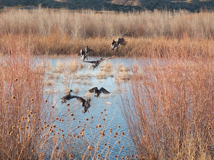
Taking Fright, Northern Pintails, Bosque del Apache National Wildlife Refuge, San Antonio NM, January 24, 2010
Startling how some days one can get lucky, swing the camera and pull the trigger, timed just so....
Night camp
Site 16 - Bosque Bird Watcher's RV Park, San Antonio NM
- This is a basic, small Mom & Pop RV Park with full hookups.
- Verizon cell phone and Broadband service are available here with a strong signal.
- Locate Bosque Bird Watcher's RV Park on my Night Camps map
- Click for Google street view
- Check the weather in San Antonio NM
Give it, Give it All, Give it Now
One of the few things I know about writing is this: spend it all, shoot it, play it, lose it, all, right away, every time. Do not hoard what seems good for a later place in the book, or for another book; give it, give it all, give it now. The impulse to save something good for a better place later is the signal to spend it now. Something more will arise for later, something better. These things fill from behind, from beneath, like well water. Similarly, the impulse to keep to yourself what you have learned is not only shameful, it is destructive. Anything you do not give freely and abundantly becomes lost to you. You open your safe and find ashes.